The Aravalli ranges/mountain determine the river system of Rajasthan.
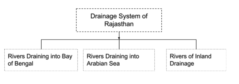
The great water divide line of India divides the rivers of Rajasthan into two parts.
The great water divide line extends along the Aravalli axis in the north to the southern part of Sambhar lake.
It goes southwest through a few kilometres east of Beawar, Deogarh, Kumbhalgarh, Haldighati in the south of Udaipur up to Udaisagar.
Further to the south-east, it passes through Bari Sadri, Chhoti Sadri and reaches up to Pratapgarh.
The rivers to the west and the south of the water divide drain into the Arabian sea. Luni, western Banas, Sabarmati and Mahi are the main rivers.
To the east of the water divide, Banas and its tributaries join Chambal, which ultimately drains into the Bay of Bengal through Yamuna and Ganga.
Nearly 50% of the area of Rajasthan does not have drainage into any open sea and is part of the inland drainage system.
Rivers Draining into Bay of Bengal
Chambal river(Charmawati)
Source of Origin: Janapav Hill, near Manpur Indore(M.P)
Chambal is the only perennial river of Rajasthan which flows throughout the year.
The total length of the river: 966km
Total length in Rajasthan: 153km
Chambal enters in state near Bhainsrorgarh,Chittorgarh
Dam on Chambal river
Gandhi Sagar(M.P)
RanaPratap Sagar(Chittorgarh)
Jhawahar Sagar(Kota, Bundi)
Kota Barrage(Kota)
Chambal makes the boundary between Kota and Bundi districts.
After taking a course in Rajasthan, it enters into U.P and meets the river Yamuna near Marudganj, Etawah(U.P)
Tributaries of river Chambal are Banas, Parvati, Kali Sindh, Parwan, Ahu, Seep.
KaliSindh river
Source of Origin: Village-Bangali, Dewas (M.P)
The river flows in a north direction from the source and passes through the Jhalwar and Baran district of Rajasthan.
It meets the river Chambal near Nonera Village(Kota)
Tributaries of river KaliSindh are Parwan, Niwaj & Aahu
Parvati river
Source of Origin: Vindhyan range in Sehore(M.P)
It enters Rajasthan near Karyahat village(Baran).
Parvati flowing through Baran district joins Chambal near the place village Pali, Khandar(Sawai Madhopur).
Ahu river
Source of Origin: Rajgarh(M.P)
Its main river Kali Sindh at Gagron Fort(Jhalawar)
Parwan river
Source of Origin: Malwa Plateau
It enters in Rajasthan at place Kharibor(Jhalawar)
It meets the main river Kali Sindh at Palayata(Baran)
Shergarh wildlife sanctuary: On the bank of the Parwan river
Tributaries of River Parwan are Newej, Kalikhard.
Banas river(Hope of the Forest)
Source of Origin: Khamnor Hills of Bhorat Plateau
Total length: 512km
It is the only river of the state which has its entire course in Rajasthan.
Dam on Banas river
Bisalpur Dam(Tonk)
Trijunction at:
Place: Bigod(Bhilwara)
River Menal and Berach, meets river Banas
Place: Bisalpur(Tonk)
River Rie and Khari meet river Banas.
Place: Rameshwaram, very close to Khandhar(Sawai Madhopur)
River Banas and Seep meet the main river Chambal.
River Banas flows through the heart of the Mewar plains.
Tributaries of river Banas are Berach, Kothari, Khari, Menal, Bandi, Mansi, Dhoondh and Morel.
Berach river
Source of Origin: Gogunda hills, north of Udaipur town.
Total length: 157km
It intersects Udaisagar & flows past the Chittorgarh fort to meet Banas near Bigod.
From its source to Udaisagar lake, it is known as Ayar river, and after that, it is called river Berach.
Tributaries of Berach river are wagan, Gujari.
Kothari river
Source of Origin: Devgargh/Diwer hills(Rajsamand)
Dam on Kothari river:
Meja Dam(Mandalgarh, Bhilwara)
Total length: 145km
It flows in Udaipur, and Bhilwara meets the Banas river near Nandrai, Bhilwara.
Khari river
Origin: Hills of Bijral Village(Rajsamand)
Total length: 80 Km
This river flows past the Deogarh town & meets the Banas near Deoli(Tonk).
Banganga river
Source of Origin: Hills of Bairath(Jaipur dist.)
Total length: 240km
Dam on Banganga river:
Jamwa Ramgarh Dam(Jaipur)
Its water spreads out into several channels in Bharatpur & one of the main channels diverted to Ajan Dam(Bharatpur), which supplies water to Keoladeo National Park.
The river finally flows up to Fatehabad(Agra dist. U.P) to meet the Yamuna river.
The river causes floods and changes its course many times in Bharatpur dist.
Gambhiri river
Source of Origin: Hills of Swai Madhopur
Total length: 110km
The river changes its course in many years.
Dam on Gambhiri river:
Panchana Dam(The largest dam made of soil in Rajasthan)
Baretha Dam
It enters the Rupbas tehsil of Bharatpur dist. & finally goes to Agra dist & meets the Yamuna river.
Massi River
Source of Origin: Kishangarh(Ajmer)
The river meets the main river Banas in Tonk.
Morel river
Source of Origin: Village – Chainpura(Jaipur)
It meets to main river Banas at Village Hadoti(Karoli)
Mej river:
Source of Origin: Mandalgarh(Bhilwara)
It meets the main river Chambal at Bundi.
Chakan river
Source of Origin: Bundi
It meets the main river Chambal at Sawai Madhopur.
Aalaniya river
Source of Origin: Hills of Mukundwara(Kota)
It meets the main river Chambal at village Notana.
River Draining into the Arabian Sea
The river originated from the western slope of Aravali & flow towards the Arabian sea.
All these rivers are ephemeral & flow only during the rainy season.
Some of the rivers of this drainage system also originate from Vindhyan mount.
Luni river
Source of Origin: Nag Pahari, Ajmer
River Saraswati, carrying the drainage of Pushkar valley, joins the Sagarmati, a tributary of Luni.
Pali city is situated on the banks of the Bandi river.
Jalore city is on the banks of the Sukari river.
Sheoganj city is on the banks of the Jawai river.
The Luni river’s water is sweet as far as Balotra but lowers down it becomes more & more saline till the river ends.
The Luni river’s tributaries are Lilri, Ghuhia, Sukri, Jojri, Jawai, Bandi & Sagi.
Of all the tributaries of Luni, only Jojri joins it from the right side.
Jawai river
Source of Origin: Village Goriya(Pali)
Dam on Jawai river:
Jawai Dam(Sumerpur, Pali)
It forms the boundary between Sirohi and Pali.
The Tributary of the Jawai river is Khari.
Sukri River
Source of Origin: Pali
It meets the main river Luni near Samdari(Barmer)
Mahi river(Khanthal Ki Ganga)
Source of Origin: Minda Village, Dhar district(M.P)
It enters Rajasthan at village Khandu(Banswara).
The Mahi river drainage at Banswara and Pratapgarh is known as “Chappan ka maidan”.
It flows in Pratapgarh, Dungarpur and Banswara’s districts and finally flows into the Gulf of Cambay in Gujarat.
Mahi and its tributaries Som and Jakham rivers meet at Beneshwar Dham to form the Triveni confluence (Sangam).
Tribal fair held every year at the Triveni confluence.
The Dham is the prominent religious place of local tribes.
Mahi-Bajaj Sagar dam has been constructed on Mahi river near Borkhera village, Banswara.
It cuts the Tropic of Cancer at two times.
Sabarmati river
Source of Origin: Village Padarla, Jhadol(Udaipur)
The river flows southward and enters Gujarat, where Ahmedabad city is situated on its banks. River Sabarmati is mainly a river of Gujarat, but it flows to a very short distance of 29km in Rajasthan through the Udaipur district.
Total length: 317km
The river falls in the Gulf of Cambay.
Tributaries of the Sabarmati River are Baval, Hathmati, Meshwa, Betrak & Majam.
All these rivers originated from Udaipur & Dungarpur but have the very least drainage in Rajasthan State.
West Banas river
Source of Origin: Naya Sanwada(Sirohi)
Dam on river west Banas
Banas Dam(Sarupganj, Sirohi)
The Tributary of the river is Sipu.
Abu Road and Disha(Gujarat) situated on the Bank of this river.
Som river
Source of Origin: Hills of Bichameda(Udaipur)
It meets the main river Mahi at Beneshwar Dham(Dungarpur)
Tributaries of Som river are Jhakam, Jhamri, Gomi.
Jhakam river
Source of Origin: Choti Sadari(Pratapgarh)
Tributaries of river Jhakam are Karmai, Sukali
It meets the main river Mahi at Beneshwar Dham through river Som.
Anas river
Source of Origin: Village Amber(M.P)
It meets main river Mahi at Galiyakot(Dungarpur)
River of Inland Drainage
Ghaggar River(Ancient Saraswati)
Source of Origin: Kalka Hills(H.P)
Total Length: 465 Km
River Ghaggar flows through Ambala, Patiala and Hisar district of Haryana.
Ghaggar flows through the Ambala, Patiala & Hisar districts of Haryana after it enters Tehsil – Tibbi, Ganganagar(Rajasthan).
The Ghaggar often causes floods during the heavy rain.
Sota-Sabi
Source of Origin:
Sota river from the hills of Bairath
Sabi river from Sewar hill.
These rivers flow in Kotputli, Bansuri, Behror & Mundawar.
Sabi river flows in the north direction, entering into Rewari & Gurgaon(Haryana State), where waters spread out, causing floods.
Kankani river/Masurdi
Origin: Village Kothri(Jaisalmer)
Total length: 27km
The river flows only during the rainy season.
Its waters finally collected into Bhuj Lake.
Kantli river
Origin: hills of Udaipurwati(Jhunjhunu dist.)
Total length: 48km
The river taking a northerly course, the river flows through Bagar & Jhunjhunu & finally terminates in the dunes of Churu.


3 Replies to “River System/Drainage System of Rajasthan”